How to Get Around the Canary Islands
Getting around the Canary Islands is not as straightforward as booking a train and moving from city to city. This Atlantic archipelago belongs to Spain but lies geographically closer to Africa, and its volcanic origin shapes everything about transportation. Deep ravines, high-altitude plateaus, winding coastal highways and sea crossings between islands mean that logistics here are different from mainland Europe. Your route, timing and budget will directly influence how smooth or stressful your trip feels.
There is no single “best” way of getting around the Canary Islands. The right transport solution depends on how many islands you want to visit, whether you plan to hike in national parks, if you are traveling with children, and how comfortable you are driving steep mountain roads.
The Geography That Defines Logistics
The Canary Islands consist of seven main islands: Tenerife, Gran Canaria, Lanzarote, Fuerteventura, La Palma, La Gomera and El Hierro. They are scattered across the Atlantic Ocean, with distances between them ranging from roughly 30 kilometers to more than 450 kilometers.
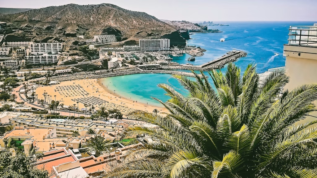
Each island has a distinct landscape profile. Tenerife and La Palma are highly mountainous, with dramatic elevation changes. Gran Canaria combines sandy beaches with rugged interior valleys. Lanzarote and Fuerteventura are flatter but remain volcanic and highly exposed to Atlantic winds. These natural features influence road design, bus routing, ferry reliability and overall travel time more than simple map distance suggests.
The key logistical nuance is this: even short distances may take significantly longer than expected due to serpentine mountain roads and steep ascents. Inter-island movement depends entirely on flights or ferries, and weather conditions, especially wind, can affect both sea and air transport in any season.
Quick Comparison of Transport Options
Before diving into details, it helps to understand when each transport mode makes practical sense. Getting around the Canary Islands requires choosing transport strategically depending on distance, schedule flexibility and travel style.
Domestic Flights Between Islands
Flying is the fastest solution for longer inter-island routes, especially when combining eastern and western islands in one trip. It works particularly well if you are traveling between distant islands such as Lanzarote and La Palma or if your itinerary includes three or more islands within limited time.
The flight itself typically lasts between 30 and 60 minutes. However, airport transfers, check-in procedures and boarding time increase the real door-to-door duration to approximately 2.5 to 3 hours.
Main regional airlines operating these routes include Binter Canarias and Canaryfly.
- When it works best: long inter-island distances, short stays, multi-island itineraries
- Pros: short flight time, frequent routes, reliable schedules
- Cons: added airport time, baggage limits, higher last-minute prices
Trains
Many visitors assume Spain means train travel, but there are currently no operational passenger railways in the Canary Islands. Discussions about future rail projects on Tenerife and Gran Canaria have existed for years, yet at present all land transport relies on road infrastructure.
- Current situation: no passenger train system
- Planned projects: discussed but not implemented
- Available alternatives: buses, rental cars, taxis
Intercity Buses
Buses form the backbone of public transportation on each island. They connect airports, towns and major resort areas reliably, especially on larger islands. While they are affordable and extensive in coverage, they require attention to timetables and route planning.
On Tenerife the operator is TITSA. On Gran Canaria it is Global. Other islands have smaller but functional networks.
- When it works best: staying on one island, budget travel, single-base trips
- Pros: low fares, broad coverage, no parking issues
- Cons: slower in mountainous terrain, reduced evening service, infrequent rural routes
Rental Car
For many travelers, renting a car is the most efficient and flexible way of getting around the Canary Islands. It allows access to remote beaches, national parks, scenic viewpoints and rural accommodations that public transport may not serve conveniently.
Car rental is especially practical on Tenerife, Gran Canaria and La Palma where mountainous interiors make bus travel time-consuming.
- When it works best: exploring remote areas, visiting multiple locations in one day, staying outside main resort hubs
- Pros: full flexibility, efficient route planning, direct access to scenic areas
- Cons: challenging mountain roads, limited parking in historic centers, additional insurance and fuel costs
Taxis and Ride-Hailing
Taxis are widely available across the Canary Islands, especially in airport zones, resort areas and larger towns. They operate on regulated fares and are generally reliable. In tourist regions, taxi ranks are clearly marked and easy to find. For airport transfers or short urban distances, taxis can be the simplest solution when getting around the Canary Islands without renting a car.
Ride-hailing apps are more limited. Uber operates in certain areas of Tenerife and Gran Canaria, mainly around major cities and resorts, but coverage is not island-wide. On smaller islands, traditional taxis remain the only option.
- When it works best: airport transfers, short city rides, travelers who prefer not to drive
- Pros: regulated pricing, wide availability in tourist zones, no navigation required
- Cons: expensive for long cross-island distances, limited app coverage outside main towns
Organized Tours and Transfers
Organized excursions combine transportation and guided experiences, which makes them especially convenient for short stays. If you have only a few days and want to visit places like volcanic parks or panoramic mountain viewpoints without managing logistics yourself, tours can save time and stress.
They are particularly useful when public transport connections are indirect or when parking restrictions apply in protected areas.
- When it works best: day trips to national parks, short visits, travelers without a car
- Pros: transport included, no planning stress, professional guide
- Cons: fixed schedules, less flexibility, per-person pricing increases total cost
Ferries and Boats
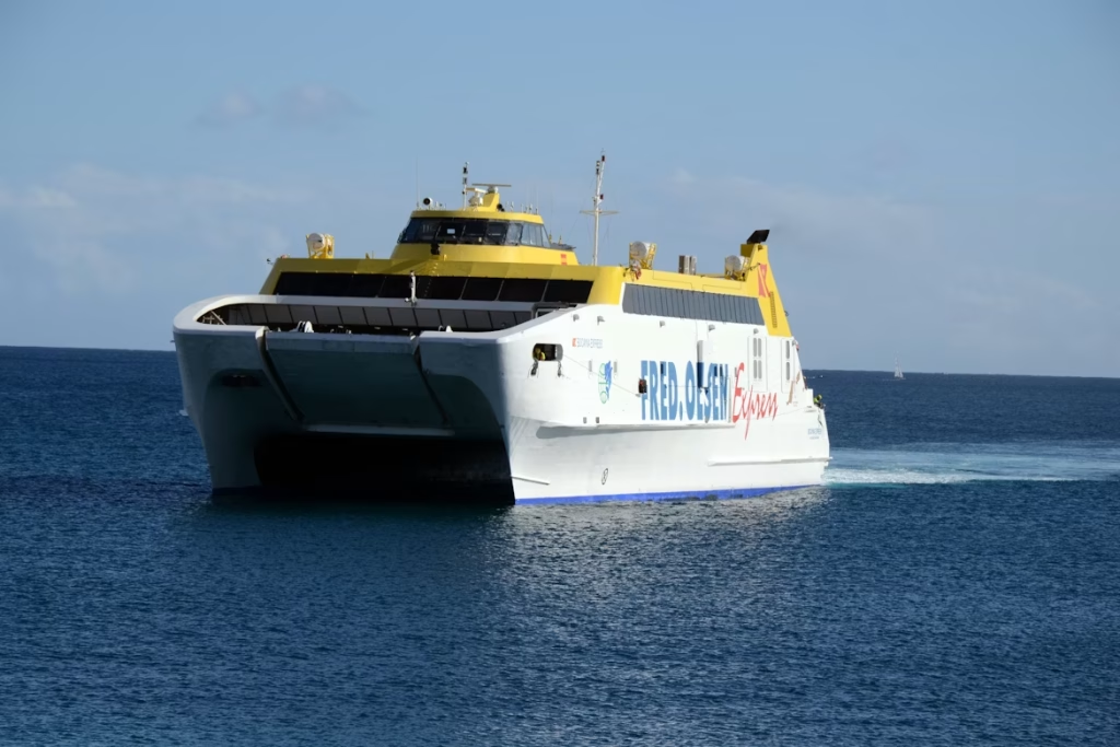
Because this is an island region, sea transport plays a central role in how to get around the Canary Islands. Ferries connect major islands daily, and on shorter routes they operate frequently throughout the day. High-speed ferries make crossings between neighboring islands relatively fast, while longer routes may take several hours.
Ferries are also the only way to transport a rental car between islands without flying. For travelers planning multi-island road trips, this becomes an important consideration.
Major ferry operators include Fred. Olsen Express and Naviera Armas.
- When it works best: neighboring islands, scenic crossings, traveling with a vehicle
- Pros: vehicle transport available, frequent short routes, ocean views
- Cons: longer than flights on distant routes, weather disruptions possible, advance booking needed in peak season
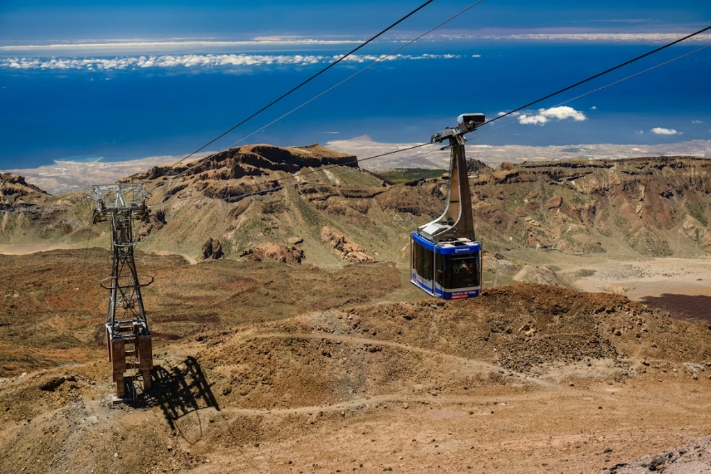
Cable Cars and Park Shuttles
Mountain areas require special infrastructure. On volcanic peaks and in protected parks, cable cars and regulated shuttle systems manage visitor flow and reduce environmental impact. These systems are not substitutes for general transport but are important for accessing high-altitude zones.
The most famous example is the cable car in Teide National Park, which takes visitors close to the summit of Mount Teide.
- When it works best: visiting volcanic peaks, accessing high altitudes, avoiding restricted parking zones
- Pros: saves physical effort, panoramic views, structured access control
- Cons: weather dependent, limited capacity, separate ticket required
Car Rental: Is It Worth It and What to Know

When a Car Is Really Necessary — and When It Is Not
For many travelers, renting a car is the most practical way of getting around the Canary Islands, especially on Tenerife, Gran Canaria and La Palma, where mountainous interiors affect travel times. Buses connect towns well but rarely reach remote hiking trailheads, cliff viewpoints or small coastal villages.
A car becomes almost essential if your itinerary includes hiking in Teide National Park, exploring central Gran Canaria, visiting hidden beaches in Fuerteventura or driving through volcanic landscapes in Lanzarote beyond the main resorts. Families and travelers staying in rural areas benefit most from this flexibility. If you are based in compact resort zones such as Costa Adeje or Playa del Inglés and plan only occasional excursions, buses and organized tours may be enough.
License, Age, Deposits and Insurance
Rental requirements are straightforward, but they vary slightly by company. Before booking, make sure you understand the following:
- EU driving licenses are fully valid
- Non-EU visitors can usually use their national license, but an International Driving Permit is recommended
- Minimum age is typically 21 or 23
- Drivers under 25 may pay a young driver surcharge
- Always confirm that insurance covers tires, glass and undercarriage
Deposits and excess policies differ between companies, so reviewing conditions in advance prevents surprises at pickup.
Parking, Restrictions and Road Conditions
There are no toll roads in the Canary Islands, but local restrictions do apply. Historic districts such as La Laguna in Tenerife or Vegueta in Gran Canaria may limit vehicle access.
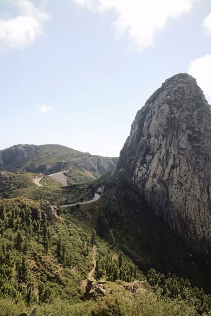
Mountain roads are paved but often narrow and winding, especially on La Gomera and La Palma. Steep gradients require cautious driving, particularly on descents.
Key driving realities include:
- No toll highways
- Restricted access in some historic centers
- Narrow mountain roads in interior regions
- Sharp curves and steep slopes in higher elevations
What Type of Car to Choose
Your vehicle should match your itinerary and group size. In most situations:
- Compact cars are ideal for couples and easier parking
- Larger vehicles suit families with luggage
- SUVs provide extra comfort in mountainous terrain but are not essential
- Automatic transmission is helpful if you are not confident driving manual on steep roads
Public Transport: How to Reduce Inconvenience
What Transport Exists and How Convenient It Is
Each island operates its own bus network independently. Tenerife and Gran Canaria offer the most extensive systems, connecting airports, towns and resort areas. Smaller islands such as La Gomera and El Hierro have fewer routes and lower frequency.
There are no inter-island buses. Travel between islands is only possible by ferry or flight.
Tickets, Travel Cards and Limitations
Tickets are usually purchased directly from the driver. On larger islands, rechargeable travel cards reduce fares, such as the Ten+ card on Tenerife. For short stays, single tickets are sufficient. For multiple rides over several days, prepaid cards are more economical.
However, public transport does have limitations:
- Evening services are reduced outside major towns
- Sunday schedules are lighter
- Rural routes may run only a few times per day
- Timetables must be checked carefully before transfers
Ferries and Inter-Island Travel
Popular Routes and Booking
Ferries connect Tenerife with La Gomera and Gran Canaria, and Fuerteventura with Lanzarote. Short crossings take about 25–35 minutes, while longer routes such as Tenerife to La Palma can take several hours.
During high season, especially winter and Easter, ferries can fill up quickly, particularly for vehicles. Advance booking is strongly recommended if you plan to travel with a car.
Traveling with a Car and Weather Risks
If you bring a vehicle on board, you must arrive at the port 45–60 minutes before departure and declare vehicle dimensions correctly at booking. Drivers remain in passenger areas during the crossing.
Because the Canary Islands are exposed to Atlantic wind, disruptions can occur. Keep in mind:
- Strong winds may cause delays or cancellations
- Smaller islands are more sensitive to rough sea conditions
- Avoid scheduling a ferry and international flight on the same day
- Leave time buffers between connections
Mountain Areas and Seasonality
Cable Cars and Access
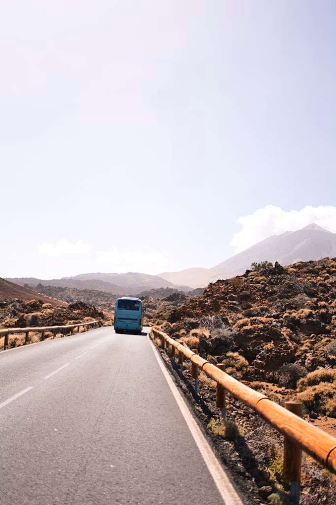
Although the Canary Islands enjoy mild weather year-round, mountain regions operate differently from coastal areas. The cable car in Teide National Park runs on limited time slots and often requires advance booking during peak months.
Parking near popular hiking trails may require reservation during busy periods due to visitor regulations in protected areas.
Seasonal Conditions and Weather Checks
High-altitude areas may experience strong wind and occasional winter snowfall. Mountain roads can temporarily close after storms, and wind in Fuerteventura may affect boat excursions.
Before heading into mountainous areas:
- Check weather forecasts
- Verify cable car operation
- Confirm road status after storms
- Allow extra time in your itinerary
Route Scenarios: Time and Budget Logic
Below are realistic examples showing how transport choices influence time and cost when getting around the Canary Islands.
Scenario 1: 4 Days on Tenerife Without a Car
This option suits short city breaks, couples and travelers who prefer not to drive. The itinerary is based on one accommodation base, either in Santa Cruz or Costa Adeje.
Transport relies on TITSA buses and possibly one organized excursion.
Time in transit
- Airport to Costa Adeje: 25-40 minutes
- Airport to Santa Cruz: 20-30 minutes
- Costa Adeje to Santa Cruz: about 1 hour 20 minutes
- Puerto de la Cruz to Teide area by public bus: about 1 hour 50 minutes each way
- Organized Teide excursion total duration: 6-8 hours
Costs
- Airport bus: €3-€10
- Local bus rides: €1-€5
- Teide excursion: €50-€90 per person
- Cable car ticket: €41-€43
Most expensive element: guided tours.
Savings tip: stay near a main bus hub and use a travel card.
Scenario 2: 7 Days Tenerife + La Gomera with Rental Car
deal for hikers and travelers seeking flexibility. Two bases are used: southern Tenerife and La Gomera.
Transport combines rental car and ferry with vehicle.
Time in transit
- Drive to Los Cristianos port: 20-30 minutes
- Ferry crossing: 50 minutes
- Ferry check-in buffer: 45 minutes
- Mountain drives on La Gomera (35-40 km): around 1 hour
- Typical daily scenic driving: 1-2 hours
Costs
- Rental car 7 days: €180-€300
- Ferry passenger: €30-€40 one way
- Vehicle supplement: €40-€70 one way
- Fuel total week: €40-€70
Most expensive element: rental plus ferry vehicle transport.
Savings tip: compare cost of taking car versus renting separately.
Scenario 3: 10 Days Lanzarote + Fuerteventura

This scenario suits beach-focused trips with relaxed pacing. Two accommodation bases are used.
Transport involves separate car rentals and a short ferry crossing.
Time in transit
- Ferry Playa Blanca to Corralejo: 25-35 minutes
- Boarding buffer: 30-45 minutes
- Playa Blanca to Timanfaya: 35-40 minutes
- Corralejo to Morro Jable: 1 hour 30-40 minutes
Costs
- Car rental total: €250-€350
- Ferry foot passenger: €20-€30 one way
- Ferry with vehicle: €70-€100 one way
- Fuel per island: €30-€60
Most expensive element: dual rental periods.
Savings tip: cross as foot passenger and rent separately.
Scenario 4: 12 Days, Three Islands by Flight
Best for travelers wanting variety within limited time. Three accommodation bases are used.
Transport relies on inter-island flights and selective car rental.
Time in transit
- Flight duration: 30-40 minutes
- Airport arrival buffer: 60-75 minutes
- Airport transfer: 20-60 minutes
- Door-to-door total per flight: about 2.5-3 hours
Costs
- Inter-island flights: €40-€95 one way
- Airport bus: €3-€10
- Taxi airport transfer: €20-€45
- Car rental (5 days): €150-€250
Most expensive element: flights booked late.
Savings tip: book early and travel midweek.
Useful Apps and What to Check Before Departure
Digital tools make planning and getting around the Canary Islands significantly easier. Navigation apps work reliably in most urban and coastal areas, but downloading offline maps is advisable for mountain regions where mobile signal may be unstable.
For transport schedules and ticket purchases, it is best to rely on official sources rather than third-party aggregators. Bus operators, ferry companies and regional airlines publish the most accurate and up-to-date timetables on their own platforms.
Useful digital tools include:
- Google Maps with offline downloads enabled
- Official TITSA and Global websites for bus routes and schedules
- Ferry operator websites for real-time updates and reservations
- Direct airline websites for inter-island flight bookings
Checking schedules and weather conditions about 24 hours before departure helps prevent missed connections and last-minute disruptions.
Conclusion

How to get around the Canary Islands is ultimately about balancing flexibility, time and budget. Distances may look short on a map, but mountains, ocean crossings and weather can reshape daily plans.
Rental cars provide maximum freedom for exploring volcanic interiors and remote beaches. Buses offer economical travel within a single island. Ferries are practical for neighboring islands, while flights save time over longer distances.
The key to successful getting around the Canary Islands is realistic timing, advance booking during peak seasons, and always checking official transport sources before departure. With thoughtful planning, moving between beaches, volcanoes and charming towns becomes part of the experience rather than a logistical challenge.